Summary:
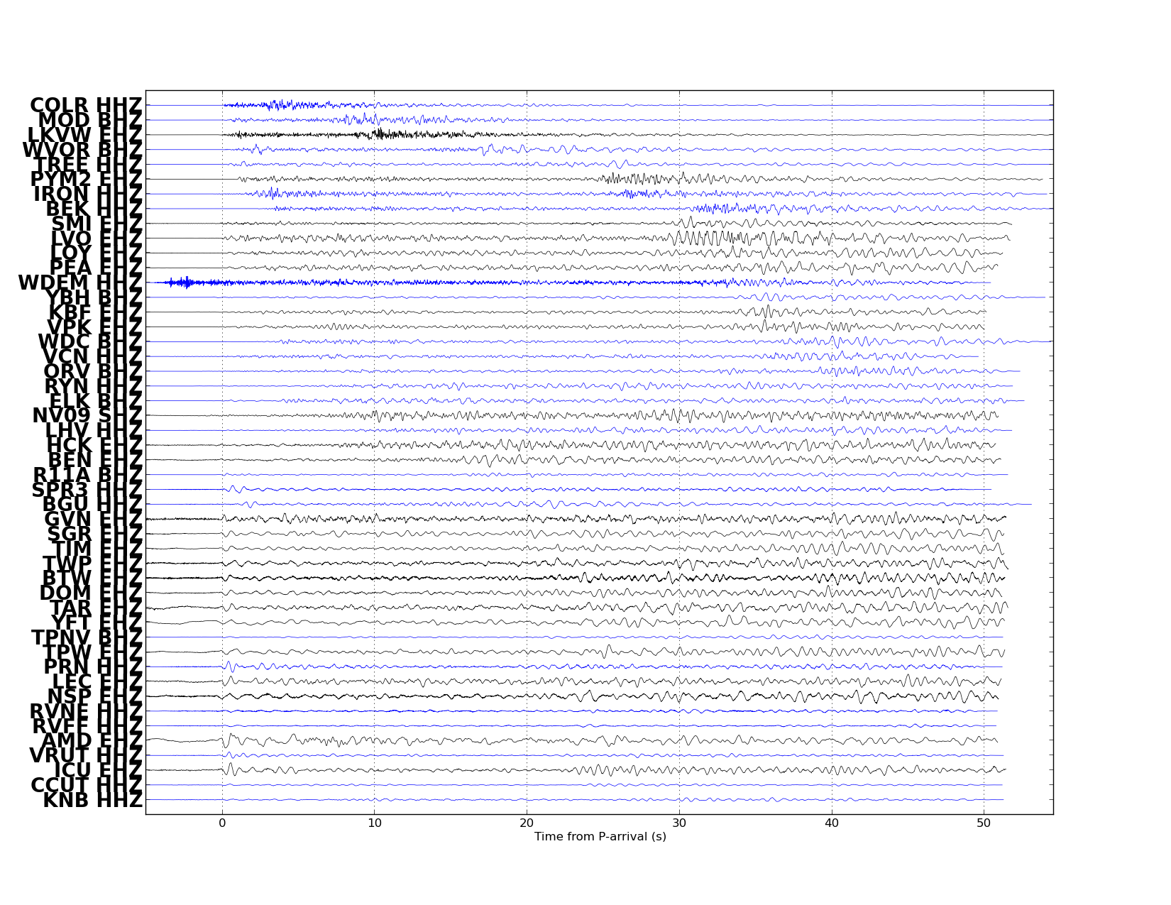
| Map includes seismicity in the last 60 days within 55 Km of this event. | ||
| ► Magnitude (ML) | 4.03 | |
| ► Region | 50.9 mi W of Denio | |
| ► Date time | 2014-11-21 at 17:20:28.221 UTC 2014-11-21 at 09:20:28.221 PST | |
| ► Location | 41.8729 ; -119.6110 | |
| ► Depth | 3.3315 km | |
| ► RMS | 0.1678 | |
| ► Gap | 189 | |
| ► Stations | 7 | |
| ► Defining Phases | 10 | |
| ► Associated Phases | 53 | |
| ► Type | Local | |
| ► Status | Reviewed | |

REVIEWED BY NSL STAFF

Event ID:468854
Origin ID:1190305
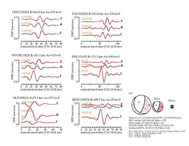
Algorithm: Ichinose (2003) Long Period, Regional-Distance Waves
Seismic Moment Tensor Solution

2014/11/21 (325) 17:20:30.00 41.8729 -119.6110 001
	Depth =   8.0 (km)
	Mw    =  3.99
	Mo    =  1.22x10^22 (dyne x cm)

	Percent Double Couple = 100 %
	Percent CLVD          =   0 %
	no ISO calculated
	Epsilon=-0.00
	 Percent Variance Reduction =  85.50 %
	 Total Fit                  =  70.48
	Major Double Couple
		            strike dip   rake
		Nodal Plane 1: 149  28 -135
		Nodal Plane 2:  17  70  -69

	DEVIATORIC MOMENT TENSOR

	Moment Tensor Elements: Spherical Coordinates
		Mrr= -0.72 Mtt= -0.17 Mff=  0.88
		Mrt= -0.40 Mrf= -0.80 Mtf= -0.13 EXP=22


	Moment Tensor Elements: Cartesian Coordinates
		-0.17  0.13 -0.40
		 0.13  0.88  0.80
		-0.40  0.80 -0.72

	Eigenvalues:
		T-axis eigenvalue=  1.22
		N-axis eigenvalue= -0.00
		P-axis eigenvalue= -1.22

	Eigenvalues and eigenvectors of the Major Double Couple:
		T-axis ev= 1.22 trend=91 plunge=23
		N-axis ev= 0.00 trend=190 plunge=20
		P-axis ev=-1.22 trend=317 plunge=59

	Maximum Azmuithal Gap=124 Distance to Nearest Station= 57.1 (km)

	Number of Stations (D=Displacement/V=Velocity) Used=6 (defining only)

	 MOD.BK.D WVOR.US.D TREE.UW.D IRON.UW.D
	 BEK.NN.D PAH.NN.D


              ---------------###
          ##-----------------######
        ###------------------########
      ####-------------------##########
     ####---------------------###########
    ####---------------------#############
  -####----   ---------------##############
  #####---- P ---------------##############
 #####-----   ---------------###############
 #####----------------------################
 #####----------------------#################
 #####----------------------############   ##
 ######--------------------############# T ##
 ######-------------------##############   ##
 #######------------------##################
 ########----------------###################
  ########--------------###################
   ########------------####################
   ##########----------###################
     ##########------####################
      ############--###################
        #############################
          #########--##############
              ###--------------


All Stations defining and nondefining:
Station.Net 	Def 	Distance 	Azi    	Bazi  	lo-f 	hi-f vmodel
            	    	(km)     	(deg)  	(deg) 	(Hz) 	(Hz)
MOD.BK (D) 	Y 	    57.1  	273  	 93  	0.020 	0.080 MOD.BK.wus.glib
WVOR.US (D) 	Y 	   101.1  	 52  	233  	0.020 	0.080 WVOR.US.wus.glib
TREE.UW (D) 	Y 	   141.8  	313  	132  	0.020 	0.080 TREE.UW.wus.glib
IRON.UW (D) 	Y 	   189.7  	 29  	210  	0.020 	0.080 IRON.UW.wus.glib
BEK.NN (D) 	Y 	   231.3  	196  	 16  	0.020 	0.080 BEK.NN.wus.glib
PAH.NN (D) 	Y 	   241.0  	176  	356  	0.020 	0.080 PAH.NN.wus.glib

 (V)-velocity (D)-Displacement

Author: www-data
Date: 2014/11/21 17:45:21

mtinv Version 2.1_DEVEL OCT2008

 index
index


