Summary:
| Map includes seismicity in the last 60 days within 55 Km of this event. | ||
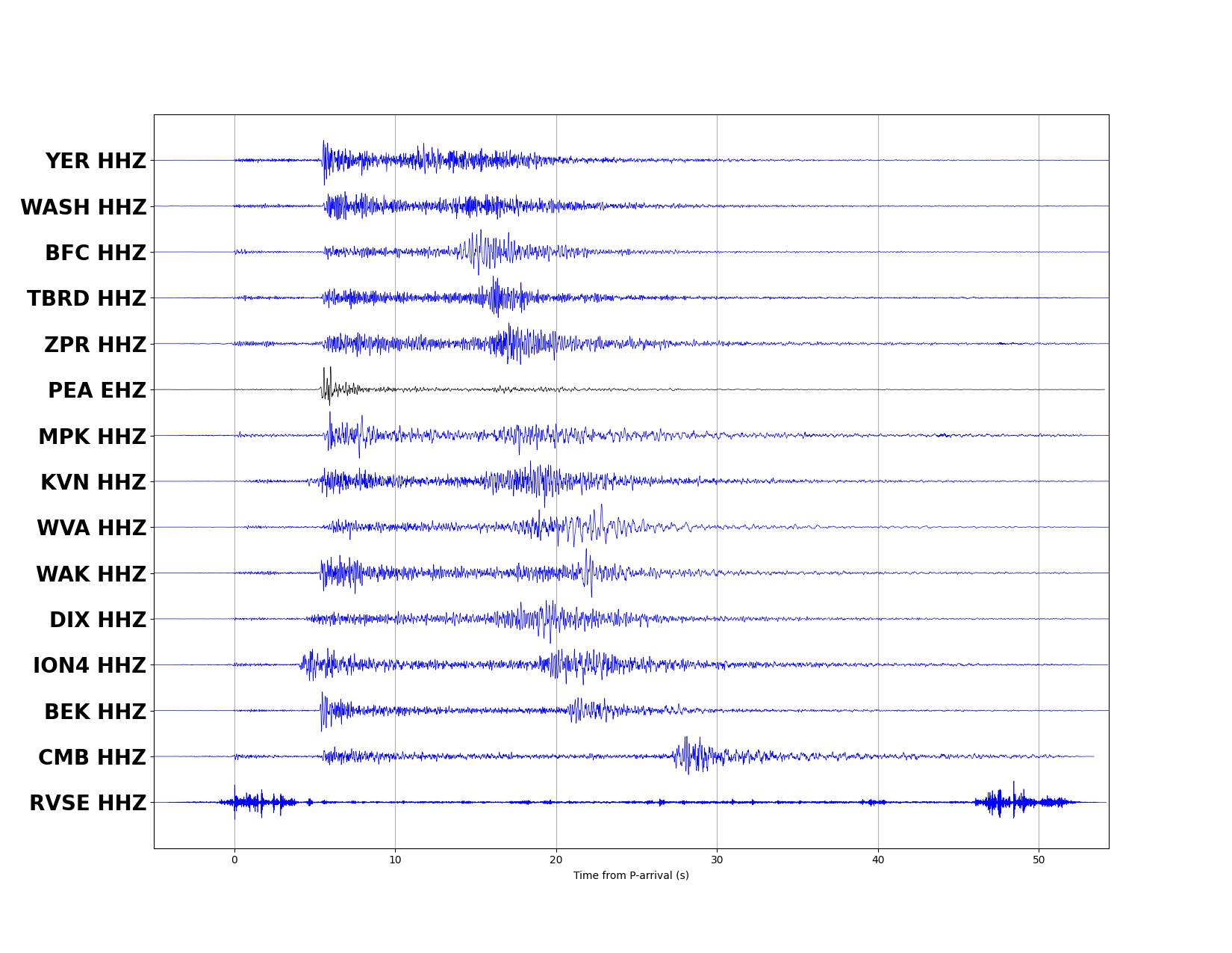
| ► Magnitude (ML) | 2.19 | |
| ► Region | 19.1 mi WSW of Fallon | |
| ► Date time | 2026-04-14 at 07:03:52.253 UTC 2026-04-14 at 00:03:52.253 PDT | |
| ► Location | 39.3211 ; -119.0740 | |
| ► Depth | 8.75 km | |
| ► RMS | 0.3334 | |
| ► Gap | 089 | |
| ► Stations | 15 | |
| ► Defining Phases | 15 | |
| ► Associated Phases | 16 | |
| ► Type | Undetermined | |
| ► Status | Preliminary | |
| ► Page Updated | 2026-04-14 at 00:06:44.457 | |